One of the most remote of Norway's 18 National Scenic Routes, the Andøya route in the Vesterålen archipelago is one of my favourites.
Norway's Lofoten islands get so much of the attention in northern Norway. But just around the corner is the much quieter Vesterålen archipelago.
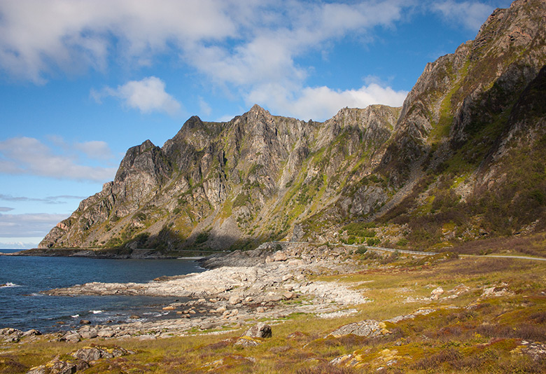
The scenery isn't quite so dramatic, but there's plenty of beautiful beaches, rocky coastline, hiking routes and ocean views to keep the curious traveller satisfied. The northernmost island, Andøya, plays host to one of Norway's National Scenic Routes.
The 18 designated routes are maintained to a high standard with interesting rest stops and facilities placed along the way.
The routes are overseen by an Architecture Council including an architect, landscape architect, and visual artist, while an arts curator helps ensure that internationally valuable works of art are part of the driving experience.
The Andøya route
The road follows cultivated land between mountain and ocean. In the summer, you can drive under the midnight sun.
There's the chance to see seals, whales and eagles depending on the time of year, while delicious cloudberries can be found on the moorland in the late summer.
As with most places in northern Norway, getting there is half the fun! Head for the small village of Risøyhamn, which is about a one-hour drive north of Sortland, the largest urban area of the islands.
As you pass through Risøyhamn, the route begins with a left turn signposted Nordmeia/Skjoldehamn. After crossing the island, you turn to the right and continue on up the coast of Andøya all the way to Andenes at the northernmost tip.
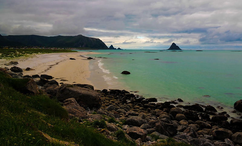
Bukkekjerka
The first stop of note comes shortly after the road meets the coastline. The old Sami sacrificial site Bukkekjerka is an imposing rock formation. Several well-trodden trails lead to the top, where a welcome bench gives you spectacular sea views.
There are also a few places to sit by the southern wall of Bukkekjerka, and a path leading out to a small islet with two unmanned lighthouses. Remains of old buildings and burial mounds can still be seen.
Stave
The small settlement Stave is known by hikers for its excellent hiking trails that reveal secret beaches and spectacular ocean views.
It's also a good choice for an overnight stop with a difference at Stave Camping & Hot Pools. During the summer a campsite is available, while in the winter beds and apartments are available to rent. Hot pools and a beach sauna are also available for use in the winter. The steaming hot pools overlook the ocean and are an amazing way to relax after a day on the trails!
Bleik
A few hundred people call the oceanside community of Bleik their home.
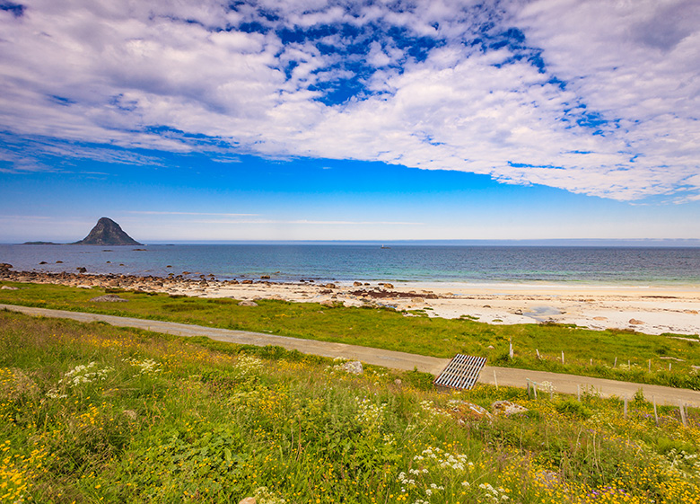
Other than fishing, the village is best known for the long white sandy beach Bleiksstranda. The village is a natural place to stop along the route for a walk along the beach, or even an overnight stop at one of the basic campsites.
Kleivodden. Another rest area is located just north of Bleik at the foot of the mountain. It's a sheltered spot from which to enjoy the ocean view, and is wheelchair accessible.
Bleiksøya. From Bleik village and Kleivodden you can clearly see the bird cliffs of Bleiksøya island. This rocky outcrop is home to more than 40,000 puffins and a large colony of sea eagles.
Andøya Space Center
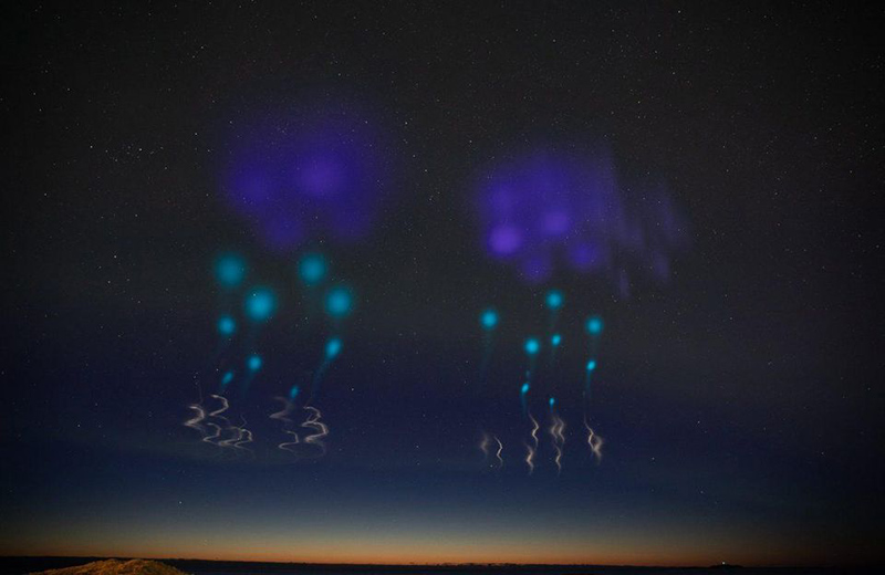
A rocket launch site in northern Norway? Yes, really! The Andøya Space Center has provided operations for both European Space Agency and NASA missions and scientific research.
Most recently, rockets launched from Andøya provided an incredible unique aurora display, visible across the north of Scandinavia.
While seeing a rocket launch is highly unlikely, the facility does welcome visitors to its aurora-themed visitor centre and exhibition. Note: The visitor centre is closed for refurbishment and planned to reopen January 2020.
Andenes
Eventually, you make it to Andenes at the northernmost tip of Andøya. Considering its remote location, it's a surprisingly active town.
It helps that the town has its own airport, Andøya Airport. That said, it now only offers regional Widerøe flights to Bodø and Tromsø after the direct route to/from Oslo came to an end a few years ago.
Update: A reader got in touch to let me know that Norwegian runs a service to/from Oslo. It’s only twice-weekly and only during the summer, but better than nothing!
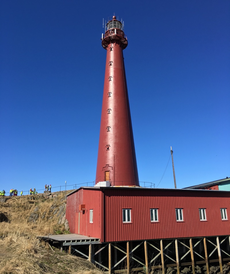
It's worth planning some time to see the town itself. There's a handful of shops, cafes, and few sights of note including this lovely deep red lighthouse.
The town is also known for its whale-watching tours and seabird safaris. If you're interested in either of these things it's best to google around for the best prices and reviews.
Also it's a very wise move to book in advance. The last thing you want to do is travel all this way only to find out the tours are not running or are fully-booked.
In the years to come, a new whale-inspired visitor centre is planned for Andenes.
Returning along the eastern side of Andøya
You can retrace your drive along the tourist route, or return to Risøyhamn along the island's eastern edge. It's a faster route and offers more coastal scenery. One sight of note is the cute old octagonal church at Dverberg dating back to 1843. It's easy to spot from the road.
What others say
Since achieving national scenic route status in 2012, the Andøya road trip has been increasing in popularity. Here's just a selection of what others have had to say about the drive:
“The northernmost Vesterålen island is arguably the most beautiful of them all. Following the coastal road that loops right around the island, you are never more than a stone's throw from the water, close to some of the country's best beaches and with great opportunity to see wildlife, including sea eagles swooping overhead and even whales out at sea.” – Moon Norway
“The drive is definitely worth it. National Tourist Route Andøya runs along the outer edge of Andøya island, and offers a magnificent view of white sandy beaches, cragged peaks and the wide expanse of the ocean. The drive over Andøya island is characterised by an impression of wide marshes, with mountain peaks rising abruptly to 700 metres above sea level. The region has been shaped by the rough Norwegian Sea. The fishing hamlets of Bleik and Nordmela reflect the interplay between people and the harshness of nature over the course of millennia (there are traces of Stone Age human settlement here).” – Dangerous Roads
“You could say it’s a relatively short distance and could be driven within an hour, but you do not want to rush it, I promise you. Instead, make sure you have at least a day – you’ll want to stop countless times to take photos, or explore small beaches, or visit villages along the road.” – Stunning Outdoors

It is nice to read about Andoya, I was an exchange student in Andenes in 1985 before tourism featured!